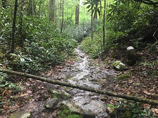
As usual when leaving town a slightly late start, first waffles at Huddle House, then hiding from storms for an hour or so before I headed off up the hill with Older Dog. After a few steep miles where the path resembled s stream in places we stopped at the first shelter for lunch and to let our shoes dry out.
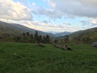
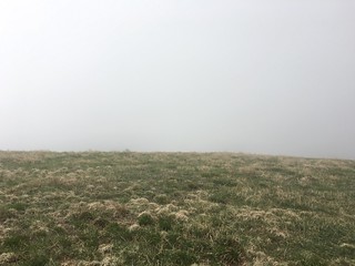
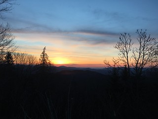
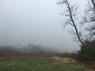
The rest of the day was uphill too ending at Beauty Spot a large grassy clearing in the summit of a hill.
Day 46: Clyde Smith Shelter
Monday 2nd May
13.9 miles
34,238 steps
336 floors
A day of pointless ups and downs of various sizes starting with a spruce covered Unaka Mountain.
Day 47: Overmountain Shelter
Tuesday 3rd May
15.6 miles
36,628 steps
353 floors
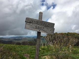
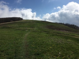
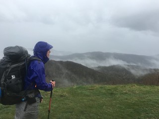
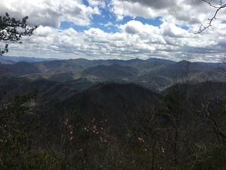
A steep start to the day featuring a small peak followed by a 2,000 foot climb up grassy balds offering views of the surrounding mountains. Just after passing Jane Bald I came across another Brit from Manchester area.
Overmountain shelter is an old barn converted in to a hiker shelter and is huge by shelter standards - sleeping around 20. I camped in the large grassy field just before the shelter with a great view down into the valley with T-Rex, Chef Ducky and the guy from Manchester (who’s name I promptly forgot). Unfortunately the following mornings weather was rubbish so no nice sunrise pictures.
Day 48: Campsite on Elk River
Wednesday 4th May
15.3 miles
36,282 miles
326 floors
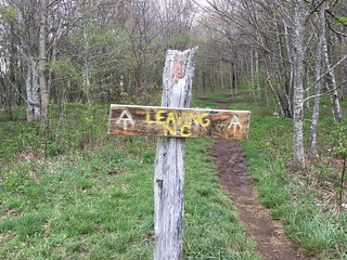
Long day with a 3 hour detour in to the small town of Roan Mountain for BBQ pulled pork and a few extra supplies (otherwise it was porridge for lunch). I wasn’t originally planning to head in to town but I bumped in to Duchess about half a mile from the road and she was looking for someone to hitch with and the mention of real food was enough to convince me.
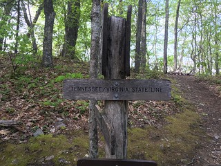
Late morning I finally left North Carolina for the last time (after zig zagging for weeks between North Carolina and Tennessee).
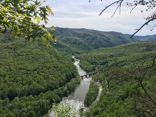
On coming out of Roan at about 4 I was surprisingly full of energy and made it to the campsite I was originally planning to stop at by about 7:30 in a beautiful spot just by the Elk River. On a warmer day I’m sure a dip would’ve been tempting. There I bumped in to T-Rex, the only hiker in camp who wasn’t already in bed.
Day 49: Moreland Gap Shelter
Thursday 5th May
11.7 miles
27,239 steps
258 floors
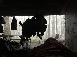
Less than a mile in to the day I passed the 400 mile point, followed by a slightly shorter day than planned as it started hailing just as I was approaching a shelter. Which, a short while later, turned in to an all night storm and torrential downpour. Also a cold night as it dropped down to only a few degrees.
Day 50: Hampton
Friday 6th May
9.5 miles + 1 mile side trail to Hampton
26,776 steps
135 floors
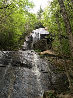
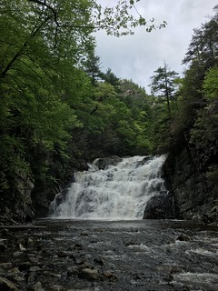
A late start while waiting for the overnight storms to clear up and hoping it would warm up (it was still only about 5 or 6 degrees by 9am). Once I’d eventually made it out of my sleeping bag it was a pretty easy day and I passed Laurel Falls, a huge waterfall, just after lunch hiking with T-Rex. T-Rex stopped about a mile or so after the falls at a shelter and I headed the additional mile and a half into the tiny town of Hampton.
Hampton looks like it used to be a nice town, unfortunately now the derelict bar, restaurants and shops make it feel unloved. After wasting time walking to the far end of town and back looking for a motel or similar, and getting distracted by Dunkin Donuts, I spent the night at Braemar Castle Hostel - named after the Scottish Castle. It was the cleanest hostel I’ve stayed in since the start and at $25 for a large private room not a bad price either.
Day 51: Campsite
Saturday 7th May
14 miles
Another late start out of town followed by straight up and down a 1,700 foot mountain.
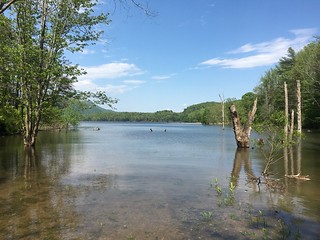
Next up was Lake Watuga a large lake used by the locals for fishing and other watery stuff. By pure luck I arrived while two lovely ladies were offering out hot dogs and fresh fruit to hikers which was all the excuse I needed for a long lunch.
Once I eventually motivated myself to continue it was on up the hill where an imminent thunderstorm made me pitch my tent for the night.
Day 52: Double Springs Shelter
Sunday 8th May
15.3 miles
A simple day of ups and downs in glorious sunshine. A few miles before the end we came across a group called Riff Raff who had set up a giant trail magic with a small village of tents and multiple gazebos. They were even offering bloody mary’s or “beer” to people as they arrived along with chilli and hot dogs.
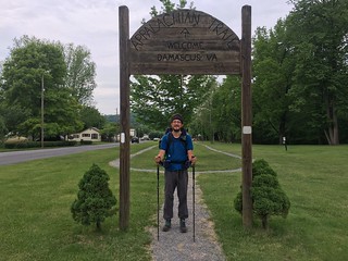
Day 53: Damascus
Monday 9th May
19 miles
My longest day so far but with a shower, proper food and beer in sight that was all the motivation I needed. The first half of the day was a surprisingly tiring but gentle uphill for 12 miles or so, followed by a long downhill in to town. Once I got in to town I checked in to The Place, a pretty basic (but functional) hostel run by the local Methodist church in return for a donation.
Day 54: Saunders Shelter
Tuesday 10th May
9.3 miles
I think this was my latest start at 2pm. I headed out of town with Pirate knowing we had three nights to cover 40 miles so there was no need to hurry. At the shelter I met an Aussie, Wanjana, who I hiked with on and off for the next few days in to Damascus.
Day 55: Campsite Elk Garden
Wednesday 11th May
14.7 miles
A fairly hard day that was all uphill. At the end of the day Pirate carried on for another few miles as he wanted to get in to Damascus Thursday afternoon.
For anybody reading this who hasn’t yet hiked this section: the water source is rubbish and back south along the A.T. I’d grab some water on the way if you’re stopping here.
Day 56: Old Orchard Shelter
Thursday 12th May
16 miles
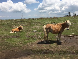
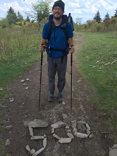
A lovely day mostly spent hiking over grassy areas, the highlight of which was Grayson Highlands State Park. The park has wild ponies and long horned cattle to keep vegetation down, the ponies are really friendly especially if they think you’ve got food, you just have to watch to make sure they don’t eat your pack. Entering the park brought the 500 mile point, helpfully spelt out on the trail in stones by another hiker.
Day 57: Damascus
Friday 13th May
1.7 miles
A very short day of walking, just 1.7 miles from the shelter down to a road the outfitters in Damascus had recommended for hitching. After 10 minutes we’d only seen one car so ended up walking about a mile and a half towards a campsite in the hope of finding more cars.
After about an hour a guy in a pickup truck came along and offered us a lift part way as he was visiting his brother, as luck would have it the brother was out so he went miles out of his way any too us all the way in to Damascus.
The big upside of getting in to Damascus is I was able to have a chat with Joe from ZPacks and show him my faulty pack, he instantly said he couldn’t repair it here and offered me a new one so I’m now the happy owner of a brand new backpack and very impressed by their customer service.
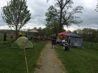
Day 58: Damascus (Trail Days)
Saturday 14th May
0 trail miles (but lots of walking)
A simple day in town with something like 20,000 extra people (only 600ish people live here). I spent most of my day trying to win free hiking gear in raffles or catching up with hikers I’ve met before including the bunch I hiked with for a while: Cade, Reboot, Kiba, Link and Woobie.
Due to a forest fire north of Hot Springs the outfitters was running free shuttles to Allen Gap missing out 14.5 miles of trail taking about half an hour up to mile 288.5.
Cade managed to miss the shuttle and Link and Reboot decided to stay behind to wait for Woobie and Kiba who were taking a second day off so it was just me heading out this time.
The earliest shuttle available when I signed up was 2pm so this ended up as a pretty short day, although it was far from the easiest at almost five miles of steady uphill climb.
Day 40: Flint Mountain Shelter
13.3 miles
33,326 steps
329 floors
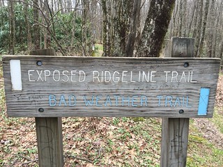
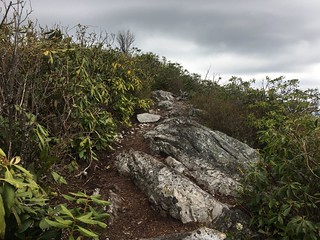
Today saw my first bad weather bypass trails on the A.T., the first avoided a rocky exposed trail up over Big Firescald Knob which I wouldn’t like to have attempted in high winds or a thunderstorm - luckily I had brilliant sunshine.
After a quick lunch at Flint Mountain Shelter, it was onwards to the second trail with a bypass of the day, this time over Big Butt Mountain. This trail was much shorter than the last exposed section but featured some very steep rocky sections that would be very difficult in ice or snow.
Day 41: Low Gap campsite
14.9 miles
38,704 steps
442 floors
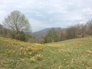
A nice day of hiking with some really pretty meadows.
Finally on arriving in to Low Gap campsite at about 5 I pitched my tent in a nice flat looking spot and settled in as normal. Within an hour the heavens had opened and a huge thunderstorm rolled in - the first of three that night. 15 minutes or so in I was starting to worry a little, a couple of inches of water had appeared outside my tent and were starting to puddle underneath. A further 15 minutes or so and it was very obvious I chose a really bad pitch, the water was now 5 inches deep and the puddle now went under my entire tent as if I’d pitched in a duck pond.
A hurried relocation later I was pitched on a bit of a slope with no chance of flooding.
Day 42: No Business Knob Shelter
14.6 miles
38,430 steps
314 floors
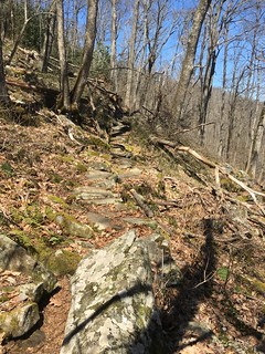
Based on the guidebook this was a deceptive day, there were a lot of uphill sections that were to short to show on the elevation profile but felt like really hard work. The general trend was uphill for the first few hours then downhill, giving us another pointless up.
The days hike ended at the weirdly named No Business Knob shelter.
Day 43 & 44: Nolichucky River, Erwin
6.2 miles
22,020
75 floors
A nice easy day mostly downhill in the Nolichucky River on the outskirts of Erwin, Tennessee. As luck would have it I arrived in Erwin just in time for a hiker bash and music festival. The hikers bash provided free food on Friday and Saturday nights at Uncle Johnny’s Nolichucky Hostel - where I got the last bunk - and the music festival on Saturday closed off the main street in Erwin for a stage and a few dozen market and craft stalls.
Tomorrows plan is to head out reasonably early back out on to the trail.
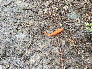
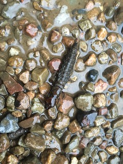
Finally while waiting for food somebody spotted a Helgramite on the path.
Getting out of Gatlinburg turned out to be fun, the shuttles were full and local taxi services weren’t answering the phone. We ended up with a mad taxi driver from Smoky Mountain Taxis who squeezed 6 of us in to a people carrier along with him and his passenger. He spent the entire journey making up completely unbelievable stories such as how he hiked the trail 6 times including turning around at the end and hiking back whilst the back suspension bottomed out every time we went over a bump.
A very short day of hiking at just 3 miles but it was all uphill and pretty hot. A downside of being in the Smokies is that you can only camp at official shelters so you end up having to pick milage based on their locations.
Day 33: Tri-Corner Knob Shelter
12.1 miles
32,241 steps
294 floors
A great sunrise got the day off to a good start at Icewater Spring Shelter.
Then the highlight of the day was a great view only a mile or so in to the trail from a rocky outcrop called Charlie’s Bunion.
Day 34: Mt. Cammerer Lookout and Davenport Gap Shelter
14.8 miles + 1.2 mile detour to Lookout
38,675 steps
225 floors
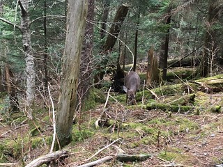
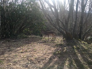
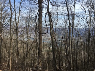
This was my final day of hiking in the smokies, I’m going to miss the great views from the mountains and hiking through the fir trees. I saw a deer shortly after leaving the shelter nibbling away at the side of the trail.
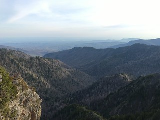
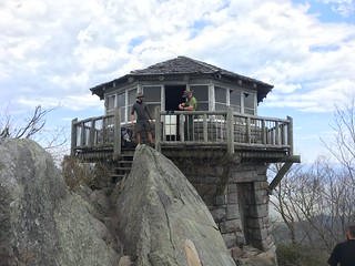
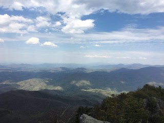
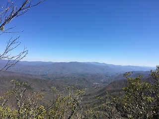
To make the day a touch longer I took a detour up to a fire lookout up on Mount Cammerer, it gave 360 degree views of the surrounding mountains - panorama on Flickr (they break my blog).
Then to end the day I camped with Cade and Reboot in the last shelter in the Smokies, just 1 mile from the boundary. It was a slightly odd experience as the shelter has a wire fence across the entrance and locking gate to keep bears out.
Day 35: Groundhog Creek Shelter
10.5 miles
31,620 steps
352 floors
One mile into the day I left the Smokies, no more strict rules about were to camp or having to stay in a dirty shelter rather than your tent.
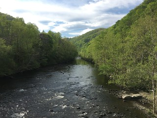
A few miles later I crossed Pigeon River and soon came to Standing Bear Farm hostel where Woobie and Link had spent the previous night at a party.
Their shop operates on an honesty system and you just note down what you take and pay as you leave, I had one of the best frozen pizzas I’ve ever had (it’s amazing how basic food makes you happy after being stuck with camping food for days).
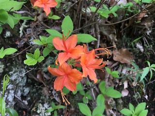
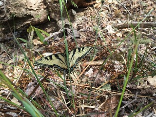
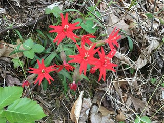
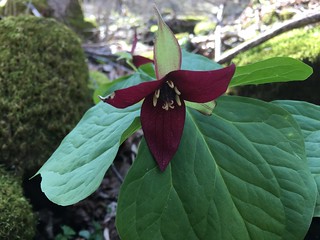
Spring is making a big difference to the trails appearance, today we came across this red flower nobody recognised.
On leaving the hostel we had a steep climb of about 2,500 foot up Snowbird Mountain which has an FAA building on the summit and signs about it affecting passenger safety.
Day 36: Walnut Mountain Shelter
13.1 miles
32,055 steps
405 floors
My first day of hiking in heavy rain, I’ve been pretty lucky with avoiding bad weather so far. It poured with rain for the first 7 or so miles until Roaring Creek Shelter where I stopped for lunch, while stopped it brightened up a bit so I carried on for another 5ish miles to the next shelter where I got my tent up just in time to avoid a thunderstorm. It then took 3 of us the best part of an hour to get a fire lit to dry things out.
Unfortunately with the heavy rain we missed out on the apparently spectacular views from Max Patch, however even with the rain it was pretty impressive.
Day 37: Hot Springs
13.5 miles
31,937 steps
225 floors
A long day with a lot of downhill (about 3,000 foot), although this being the A.T. they made sure to put in some uphill bits too. Luckily we had some good motivation, a night in town were we could get beer and food. It started off pretty foggy, only finally burning off a couple of miles from town.
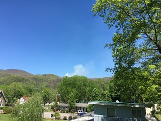
Our final bit of news as we entered town was that the mountains just the other side of town were on fire and the next 14 miles of trail are closed. It sounds like we’ll be making a detour.
Day 38: Day off in Hot Springs
A lazy day of doing nothing in Hot Springs including a soak in the hot springs the town is named after.
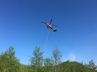
Heading down to the Spa we could see the smoke rising over the mountains from the forest fires and the helicopter with giant water dropping bucket came in to land just as we arrived.
I ended up taking two days off at Fontana rather than the planned one as the other guys I’ve been hiking with ended up arriving a little later than expected bringing along a new member, Link and his dog Kid (the most relaxed dog I’ve ever met - she even ignores food).
It turns out Fontana isn’t the most exciting place in the off season, the pools were closed and the cheaper restaurant only opens weekends. So we ended up doing a lot of sitting around, drank a few beers and watched the campfire.
Day 27: Birch Spring Gap Campsite
6 miles
20,685 steps
297 floors
Another late start coming out of town, but one with a great view. The resort shuttled us for to the dam were we left off a few days earlier, and we then walked across Fontana Dam.
Once the Dam was out of the way it was a pretty level mile and then on on to the big challenge of the week, a The Great Smoky Mountains. As luck would have it delaying staring the Smokies by a day brought us beautiful clear weather rather than the previous day’s grey.
The smokies get off to a steep start with a rise of a little over 2,000 foot over the next 2.5 miles. The steep ascent tired us out quite quickly so we were all glad to get in to the campsite after a relatively short, but steep, 6 miles.
Day 28: Spence Field Shelter
11.1 miles
29,352 steps
360 floors
A lovely sunny day for hiking with a touch of wildlife thrown in. After hearing woodpeckers on and off fur the last few weeks I’ve now seen one too. It was a red-headed woodpecker slowly making itself a hole, and then later in the day I saw a turkey wandering around the valley below the trail. Unfortunately no photos as they were too far away.
Day 29: Silers Bald Shelter
11.8 miles
32,719 steps
416 floors
A deer was eating from a bush as we left the shelter and didn’t seem to care that Cade and I were watching.
It was lovely and sunny again with lots of up hill stretches. Tempted to give up for the day half way at Derrick Knob Shelter but glad I pushed on as it made the steep climb up to Clingmans Dome much easier. Also got to pass a minor milestone - less than 2,000 miles of trail left!
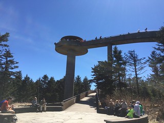
Day 30: Clingmans Dome & Mount Collins Shelter
7.8 miles + 1 or 2 miles off trail
27,291 steps
289 floors
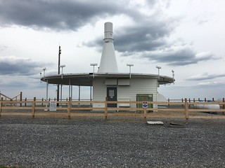
A big trail milestone in this section, Clingmans Dome is the highest point on the whole trail. It’s topped by an observation tower peaking at 6,667 feet, giving great views of the surrounding Smoky mountains. Just after the mountain is the 200 mile mark. If your on the A.T. heading to Clingmans I can recommend avoiding the shop, it’s 0.5 miles down a steep hill and only sells lukewarm water and overpriced chocolate. More importantly you then have to walk back up the hill.
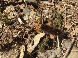
After spending a few hours there it was just a few miles downhill in to the shelter which had dome lovely camping spots under the trees. Not much wildlife but I did see a woolly bear bug.
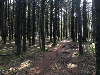
This was a really nice days hiking as we were passing through a wood of fir trees all day providing a really nice smell and welcome shade.
Day 31: Newfound Gap for Gatlinburg
4.5 miles
16,541 steps
81 floors
A early start to make sure we made it to Newfound Gap in time for the free NOC shuttle and a fairly easy 4.5 miles of mostly downhill hiking. In the end we got there about 45 minutes early, just in time for a free shuttle in to Gatlinburg from the First Baptist Church.
Gatlinburg is a southern tourist town. Everyone here is a tourist so it’s full of restaurants and shops selling tat.
On the plus side the hotel was clean and it was great to have a shower after 5 days on the trail. I had the thickest pancakes I’ve ever seen for breakfast.
A relaxed start to the day with coffee and omelette from the Nantahala Outdoor Center (NOC) restaurant and picking up a few supplies, Cade and I left the NOC at about 10:30 heading for Sassafras Gap shelter.
Unlike the first hour or two of the day the rest wasn’t so easy, the NOC is at 1,700 foot so we had 5.8 miles to climb 3,000 feet of hills with paths ranging from wide flat muddy trails through to rugby ball sized boulders. Then finally down a few hundred feet to the shelter.
We made it to the shelter with perfect timing there were only a few people there and we just beat the rain and hail. Cade and I grabbed ourselves spaces before it filled up and settled in for a long afternoon (there’s not much to do).
Within a couple of hours the shelter was jam packed - 16 people in a shelter designed for 14 - with our final arrival being Chatterbox (or The Gatherer as he thinks he’s called) who only shut up once he’d started snoring. We passed the time with chatter and food including some good anecdotes from Argon about making explosives in high school chemistry classes (he’s the teacher) and Cade about spreading MDMA across a road.
Day 22: Stecoah Gap
6.7 miles
19,375 steps
173 floors
As with all shelter stays we were up fairly early, once one person is up everyone ends up getting up.
It was then just over a mile of uphill to the top of Cheoa Bald at 5,062 feet where there was snow/hail on the ground and fog in the air.
From there the guide made it look easy, a 1,900 foot drop down to Stecoah Gap over about 5 miles. What the guide glosses over are the 3 small but very steep peaks we’d need to go up and yet more rugby ball sized rocks on the way down.
On finally arriving at Stecoah Gap we found a great welcome, free apples and bananas, and then waited for Cynthia to shuttle us to Creekside Paradise on the A.T., our home for the night.
Day 23: Yellow Creek Mountain Road
7.7 miles
19,963 steps
232 floors
After a tasty breakfast of fresh fruit and bagels Cade and I got a lift back to Stecoah Gap from Jeff and then slack packed (carried just a day pack, leaving the backpack behind) up some steep hills called Jacobs Ladder for just under 8 miles before spending another night at the B&B. Surprisingly Jacobs Ladder wasn’t too bad at all, it seems people online have been exaggerating.
Day 24: Fontana Dam
8.7 miles
20,845 steps
194 floors
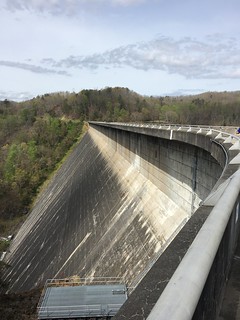
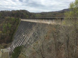
Another day of slack packing - we’ve got a cabin reserved in Fontana for Monday night so there’s no point hurrying - this time only a relatively short 500 foot ascent followed by a long descent down to Fontana Dam. Fontana Dam is the tallest dam in the eastern US and a hydroelectric power station built during World War 2.
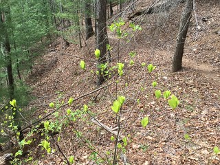
This was our first day of hiking where we could see the days goal for a good chunk of the day. Fontana lake and dam could be seen through the trees getting closer as we went. We also had a nice smattering of Spring plants starting to appear along the trail and at last saw a Sassafras plant, the namesake of four gaps so far.